What does the Destination sign mean?
The Destination sign (MUTCD D1-1, D1-2, D1-3) is a guide sign under the federal Manual on Uniform Traffic Control Devices, the national standard the states build from. It names the places reached by the route and the direction to take.
Source: MUTCD 11th Edition (FHWA), checked 2026-09-09.
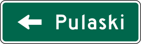
What shape and color is the Destination sign?
| MUTCD code | D1-1, D1-2, D1-3 |
|---|---|
| Group | Guide and service signs |
| Shape | Horizontal rectangle |
| Color | Green background, white legend, arrow and border |
What a horizontal rectangle means. Usually guidance: direction, distance and destination. Also used for some regulatory plaques mounted under another sign.
What green means. Permitted movements, direction, distance and destination guidance.
Guide and service signs. Direction, services, recreation: three colors doing three jobs, and not one of them carrying a duty. Work out which job the color does and most questions in this group answer themselves.
Where is a D1 destination sign supposed to stand?
Section 2D.36 of the MUTCD 11th Edition (December 2023) says a Destination sign (D1-1 through D1-3), if used, shall be a horizontal rectangle showing the name of a city, town, village, or other traffic generator, with a directional arrow. The exception is signing on a conventional road approaching an interchange, which Section 2D.49 handles separately. The Gross board faces traffic leaving the freeway on its exit ramp, not traffic approaching the interchange.
Paragraph 09 of that section says Destination signs should be used where U.S. or State numbered routes meet Interstate, U.S., or State routes, and where they send traffic from a numbered route to a town's business section or to places reached by unnumbered roads. Section 2D.42 places them, in high-speed areas, 200 feet or more before the intersection and after any Junction or Advance Route Turn assembly, with at least 200 feet between them in rural areas. Urban areas may use shorter distances. Because the Destination sign ranks below the Junction, Advance Route Turn, and Directional assemblies, it may be left out where there is not enough room for proper spacing.
How do you read the Gross ramp sign without guessing?
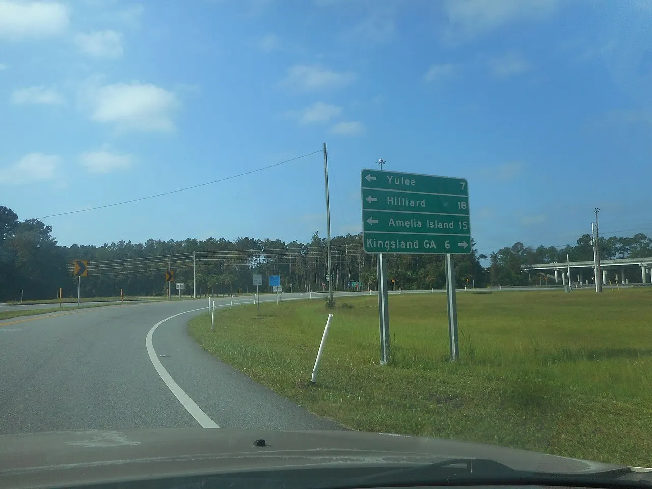
The sign near the end of the northbound I-95 ramp to US 17 in Gross lists four names. From the top: Yulee 7, Hilliard 18, and Amelia Island 15, each with a left arrow at the left edge, then Kingsland GA 6 with a right arrow at the right edge. Each mileage sits to the right of its name.
That layout follows the Standard in Section 2D.36: a right arrow goes at the extreme right, a left arrow at the extreme left, and distance numerals, when used, go to the right of the names. Showing distances is the D1-1a through D1-3a option; a plain D1-1, D1-2, or D1-3 need not show miles. A Distance sign (D2 series) under Section 2D.43 is a separate design with no more than three names and distances to the nearest mile.
Four names on one panel is itself an option. Paragraph 11 says four destinations should go on two separate signs at two locations if space permits, and paragraph 12 allows a single sign where space does not permit or where all four lie in one direction. When a single four-name sign is used, paragraph 13 requires a heavy line across the sign, or separate signs, to divide the destinations by direction. On this board white lines run across between every row, so the line above Kingsland does that job. Paragraph 15 requires a nearer destination to sit above a farther one in the same direction. Yulee at 7 is on top of the left group, which fits. Hilliard at 18 sits above Amelia Island at 15, which does not.
Does the arrow decide who goes first?
Left turn toward a place the green sign names
The driver turning left yields.
A guide sign arrow gives a direction, not the right-of-way. Florida section 316.122 still has a left-turning driver yield to oncoming vehicles close enough to be an immediate hazard.
The Gross photo does not clearly show how the end of this ramp is controlled, so the diagram shows the general left-turn rule rather than this exact junction. Any stop sign or signal at the ramp end still governs. The green sign only answers which way each place is.
Section 2D.43 caps a Distance sign at three names, with distances to the nearest mile, and its legend is names and miles with no turn arrows. The Gross board has four names, an arrow on every line, and a split between left and right. Its miles are the optional distances a destination sign may carry.
Priya wants Kingsland, not the beach
Priya near the end of the I-95 ramp in Gross
- 1She has left northbound I-95 on the ramp to US 17. The green board stands beside the ramp, not overhead on the freeway.
- 2Kingsland GA is the bottom line, arrow to the right, numeral 6. Yulee, Hilliard, and Amelia Island are the three left arrows.
- 3She takes the right. The 6 is miles to Kingsland, not an exit number and not a speed. Amelia Island at 15 is a left turn even though 15 is larger than 6.
Outcome. She turns right toward Kingsland, 6 miles by the sign. Turning left because Yulee is the top line would send her toward Yulee, 7 miles the other way.
What do people misread on the test?
- A green guide sign names places. It does not require or forbid a turn. That job belongs to regulatory signs and signals.
- The top line is not always "straight ahead." Paragraph 14 of Section 2D.36 puts the closest straight-ahead destination on top, then the closest to the left and to the right, in that order. The Gross board has no straight-ahead line, so its left group comes first.
- Paragraph 10 ties the count to the upstream guide signs: where the Advance Guide and Supplemental Guide signs show three or fewer destinations, the Destination sign shows no more than three, and where they show four, no more than four.
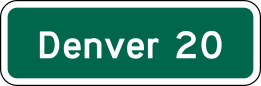

Distance signs list miles and no turn. A street name sign identifies the cross street. The gore sign marks the split itself.
What is the Destination sign often mistaken for?
Distance signs (D2 series), which give mileage rather than a turn direction.
| |
|---|---|
| GroupGuide and service signs | GroupGuide and service signs |
| ShapeHorizontal rectangle | ShapeHorizontal rectangle |
| ColorGreen background, white legend, arrow and border | ColorGreen background, white legend and border |
| What it meansNames the places reached by the route and the direction to take. | What it meansLists upcoming places and how many miles away they are. |
What does the permit test ask about the Destination sign?
This question is from the practice bank, with the answer marked.
A sign in this color carries:
- A.A warning about the road ahead
- B.Directions, distances and destinations(correct answer)
- C.A traffic law you must obey
- D.A motorist service such as fuel or lodging
Source: MUTCD D1-1, D1-2, D1-3
Questions drivers ask about the Destination sign
Why is Kingsland at the bottom when it is only 6 miles away and Hilliard is 18?
Because the sign groups names by direction, not by distance. Paragraph 14 of Section 2D.36 orders the groups: straight ahead first, then left, then right. Yulee, Hilliard, and Amelia Island share the left direction, so they stack together, and Kingsland, the only right turn, comes last under the line. A 6 mile right turn can sit below an 18 mile left turn.
Are those mile figures to the town limit or to downtown?
Section 2D.36 points to Section 2D.43 for the distance on a destination sign. That section says the owning agency or statewide policy picks the point, using a well-defined central area or central business district where one exists, and otherwise the spot most drivers would think of as the center of the community. The Gross sign does not say which point was used. Read 7, 18, 15, and 6 as the distances the sign states, not as a promise about a particular address.
The nearer town is supposed to be above the farther one. Why is Hilliard above Amelia Island?
Paragraph 15 of Section 2D.36, a Standard, says that when more than one destination is shown in the same direction, the nearer name shall be above the farther one. Yulee at 7 miles is above the other left-hand names, which matches. Hilliard at 18 miles is above Amelia Island at 15 miles, which does not. The sign still tells you both are to the left. Use the arrows for the turn, and treat the Hilliard and Amelia Island order as out of step with that one rule.
Do I have to be in a certain lane because of this sign?
A roadside destination sign gives directions, not lane assignments. Section 2D.36 says overhead destination signs may assign lanes on the approach to a multi-lane intersection, and Section 2D.37 allows overhead Arrow-per-Lane signs on conventional roads only for multi-lane approaches that have an option lane. The Gross board is a ground-mounted rectangle beside the ramp. It tells Priya right for Kingsland and left for the other three, and nothing about which lane to use.
Sources
- MUTCD 11th Edition (FHWA)
- MUTCD 11th Edition (December 2023), Chapter 2D, Sections 2D.36, 2D.37, 2D.42, 2D.43 and 2D.49
- Florida Statutes section 316.122 (2025), Vehicle turning left
What are the other guide and service signs?


All 11 guide and service signs on one page, or every US road sign by shape and color.
Test yourself on this sign and the rest of the set with a road signs practice test for Florida, Texas, California or New York.
The artwork is the federal design itself, which the manual dedicates to the public domain in MUTCD 11th Edition, Part 1, Section 1D.06, checked 2026-09-09. The Interstate Shield, the 511 pictograph and the National Scenic Byway graphic are named exceptions and are not reproduced anywhere on this site.
Source: Manual on Uniform Traffic Control Devices, 11th Edition. Not affiliated with or endorsed by the Federal Highway Administration or any state agency.